Talk
Mapping Population Censuses and Road Networks in the Ottoman Empire, c. 1830-40
Tuesday, April 10, 2018
2:30 pm
DHLab (SML 316)


In this Office Hours talk, Veysel Simsek will discuss new findings on Ottoman population censuses and road networks in the early 19th century. The figures and geospatial data he will discuss were extracted and processed from indigenous archival material, some of which has never been utilized. Simsek will present his geospatial visualization of the census data and the road network for methodological discussion and feedback from the audience.
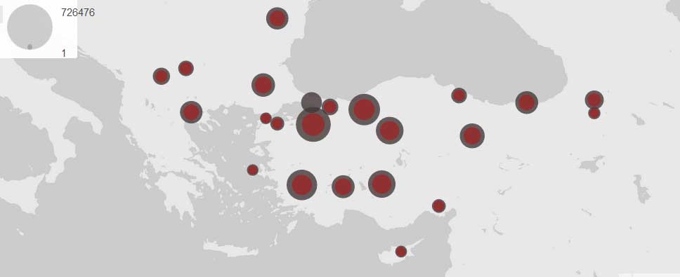
The population surveys carried out between 1829 and 1832 are often regarded as the first “modern” Ottoman census-taking effort. They were aimed at determining the available manpower and tax base for the Ottoman central authority which had initiated an ambitious program of military and administrative expansion and reform. By assessing archival data, Simsek will argue that the Ottoman central authority did not take a new census of its male subjects in 1844 except for in Istanbul, but in fact, it constantly updated its initial registers for the provinces that had been compiled in 1830-1832 through its bureaucratic bodies between 1832 and 1843. The geospatial visualization of the census data from 1829-1832 and 1844 are presented in a comparative fashion to make it much easier to convey an otherwise complicated argument.
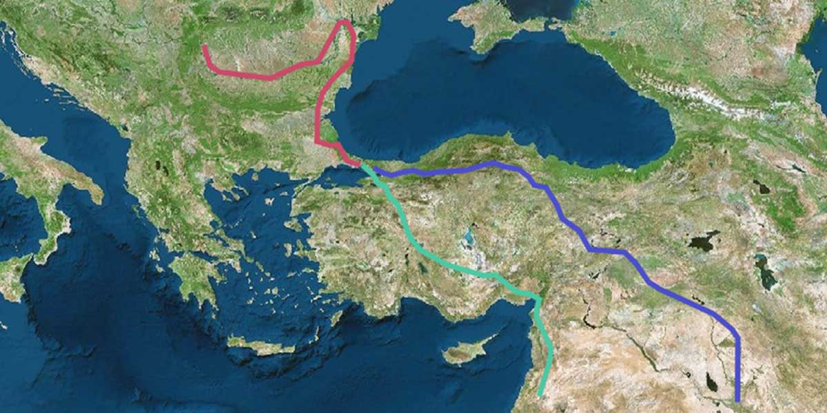
Following the Turco-Mongolian tradition of rapid and safe movement of information, armies, and merchants through their lands, the Ottoman state was extremely attentive to its road network and the messengers on horseback. A detailed register located in the former private library of Hüsrev Paşa (d. 1855), the long-term commander in chief of the reformed, European-style Ottoman army in 1820s-1830s, shows the distances in hours between post stations and the names of those post stations along the major and minor routes in hours circa 1830. While such “catalogs” are not rare, this document is unusually comprehensive. In this presentation, Simsek will visualize these routes by processing and marking geospatial data of nearly 150 stations. An attempt is also made to demonstrate the distances between postal stations in hours on the map to provide the audience a more accurate sense of geography, distance, and time, which are often missing in conventional studies on the Ottoman history.
Veysel Simsek is a postdoctoral associate in International Security Studies at Yale University.